Lab 03: Data Entry and Digitizing
1 Introduction
This lab focuses on the processes of manual and on-screen digitizing within ArcGIS Pro. The primary goal is to digitize features from aerial imagery and other source media, creating accurate vector data layers.
2 Objectives
- Digitize features such as buildings, roads, and ponds using ArcGIS Pro.
- Utilize snapping tools to ensure precision in editing.
- Save and export digitized features in map formats.
3 Tasks
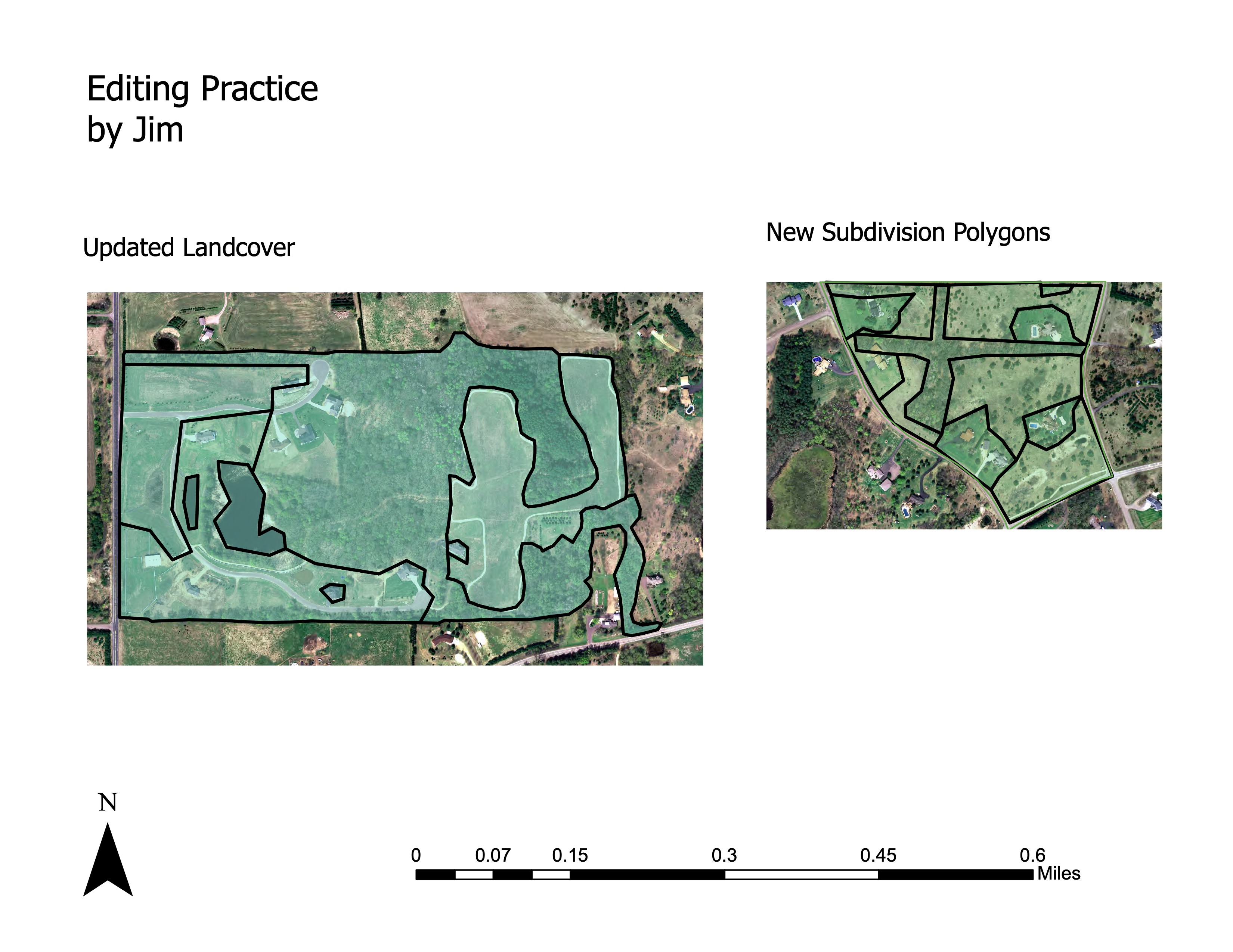
3.1 1. Digitize Landcover and Subdivision Polygons
Use aerial imagery as the base layer to digitize landcover and new subdivision polygons. Apply snapping tools to ensure that all features are correctly aligned.
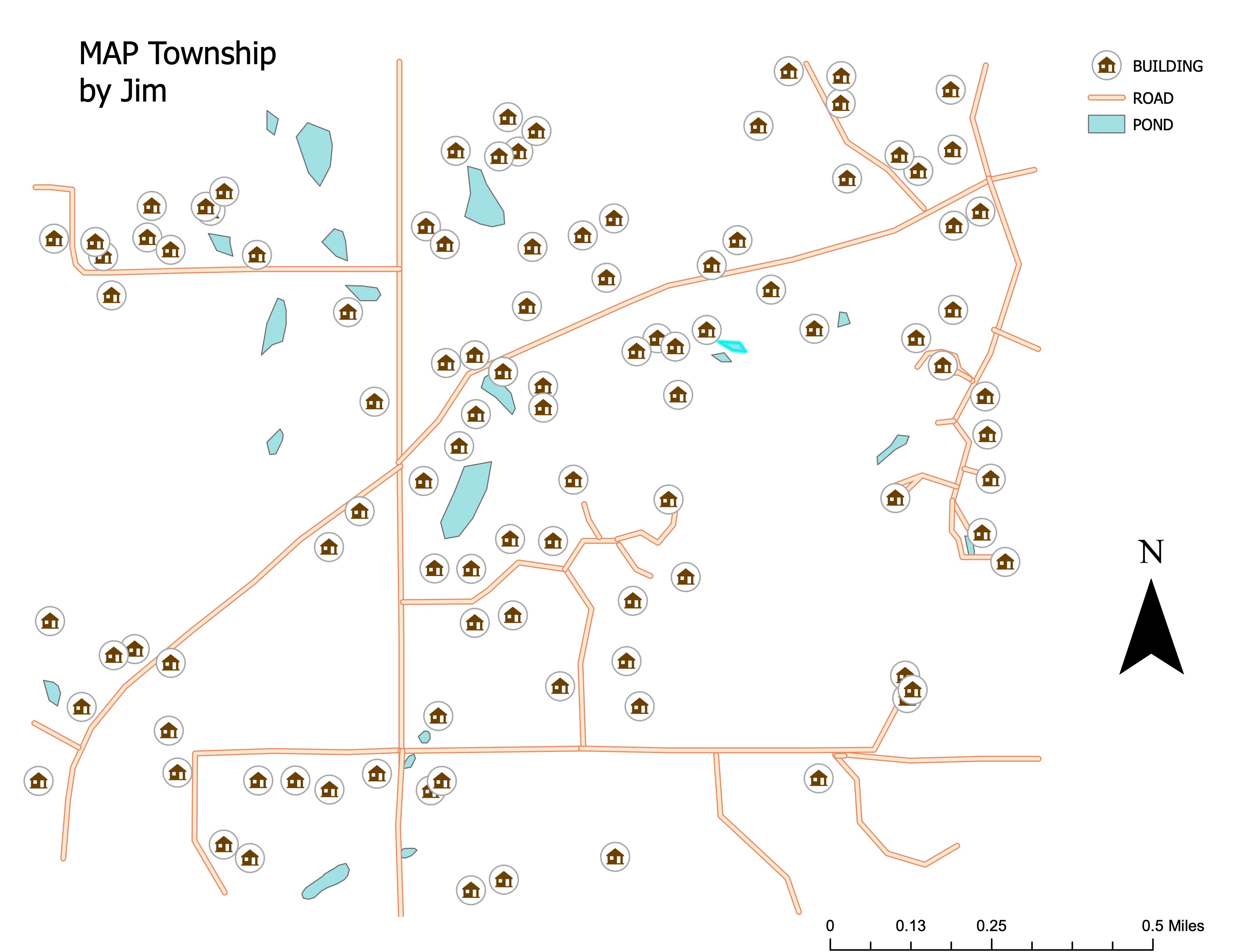
3.2 2. Digitize MAP Township Features
Trace and digitize features such as buildings, roads, and ponds in MAP Township. Ensure each feature is accurately represented in the vector data layer.
4 Results
4.1 Updated Landcover and Subdivision Polygons
4.2 MAP Township Digitized Features
5 Conclusion
Digitizing features from aerial imagery allows for the accurate creation of vector data layers, essential for many GIS applications. Proper use of snapping tools ensures that digitized features are precise, which is critical in producing reliable spatial data.