Lab 04: Digitizing and Topology
1 Introduction
This lab focuses on digitizing and creating topological rules within ArcGIS. The main tasks involve setting up a digitizing environment, creating and editing feature layers, and applying topological rules to ensure the accuracy and integrity of the digitized data.
2 Objectives
- Understand the process of digitizing features using ArcGIS Pro.
- Apply topological rules to maintain spatial relationships between digitized features.
- Validate and correct topological errors within the dataset.
3 Tasks
3.1 1. Preparing the Data
- Start ArcGIS Pro and create a new map project.
- Load the provided RectSpring image and add the
Lab4AP.gdbto the project. - Include the necessary layers (
NWI,MNDOT,DNR lakes, andSouthBayAreafeature classes).
3.2 2. Digitizing Upland and Lake Boundaries
- Use the RectSpring image to digitize the upland/lake boundary within the
SouthBayArea. - Digitize aquatic vegetation using both the RectSpring and BigMarSum images.
- Ensure the boundaries are accurate by switching between images for better visual cues.
3.3 3. Creating and Validating Topology
- Set up a topology for the digitized layers within the feature dataset.
- Define the necessary topology rules to prevent overlaps, gaps, and ensure spatial integrity.
- Validate the topology and identify any errors.
4 Results
4.1 Digitized and Validated Topology
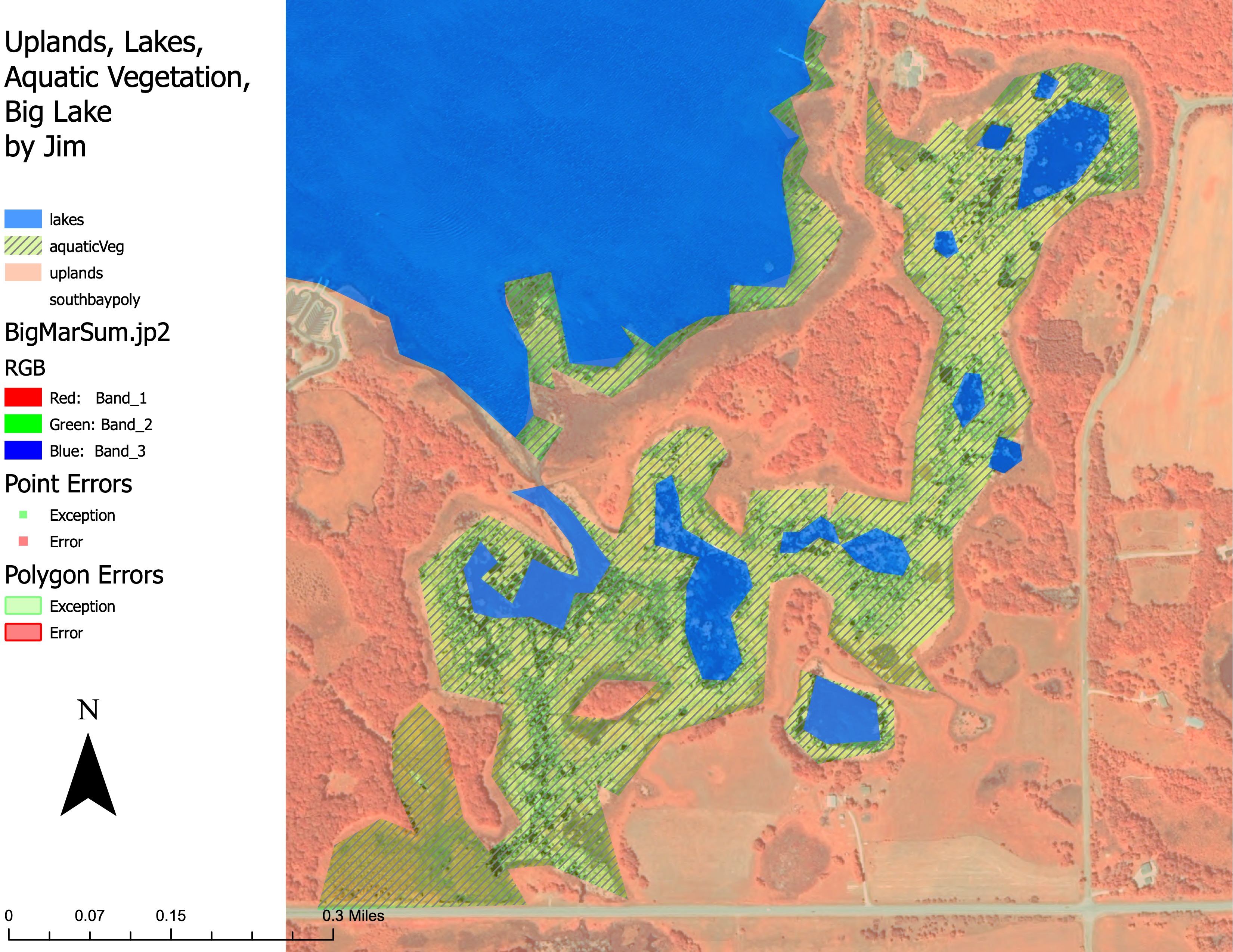
The following images show the results of the digitizing and topology validation process.
4.1.1 Uplands, Lakes, Aquatic Vegetation, Big Lake by Jim
5 Conclusion
Digitizing and topology validation are crucial processes in GIS to ensure that spatial data is accurate and reliable. By following proper digitizing techniques and applying topological rules, one can maintain the integrity of spatial relationships in the dataset. This lab provided hands-on experience in setting.