Lab 09: Raster Analysis
1 Introduction
This lab focuses on spatial analysis and modeling using raster data. The goal is to estimate access costs across a landscape based on factors like slope and distance to roads. The process includes raster resampling, combining DEMs, filtering data, and creating cost surfaces. The lab also includes a project on correcting DEMs and generating hillshade maps.
2 Objectives
- Learn to mosaic raster data with different resolutions.
- Apply filtering techniques to correct noisy DEM data.
- Develop cost surfaces using slope and distance factors.
- Use raster calculator for advanced spatial analysis.
3 Tasks
3.1 1. Mosaic DEMs and Generate Hillshade
- Combine Valley3 and Valley9 DEMs, and generate hillshade maps for both.
- Resample Valley9 DEM to match Valley3’s 3-meter resolution.
- Combine the two DEMs into a single dataset using raster calculator.
3.2 2. Correct DEM Artifacts Using Filters
- Apply a low-pass filter to the Shasta DEM to correct data spikes and pits.
- Generate a new hillshade map to visualize the corrections.
- Subtract the filtered DEM from the original DEM to isolate errors, then replace erroneous cells using raster calculator.
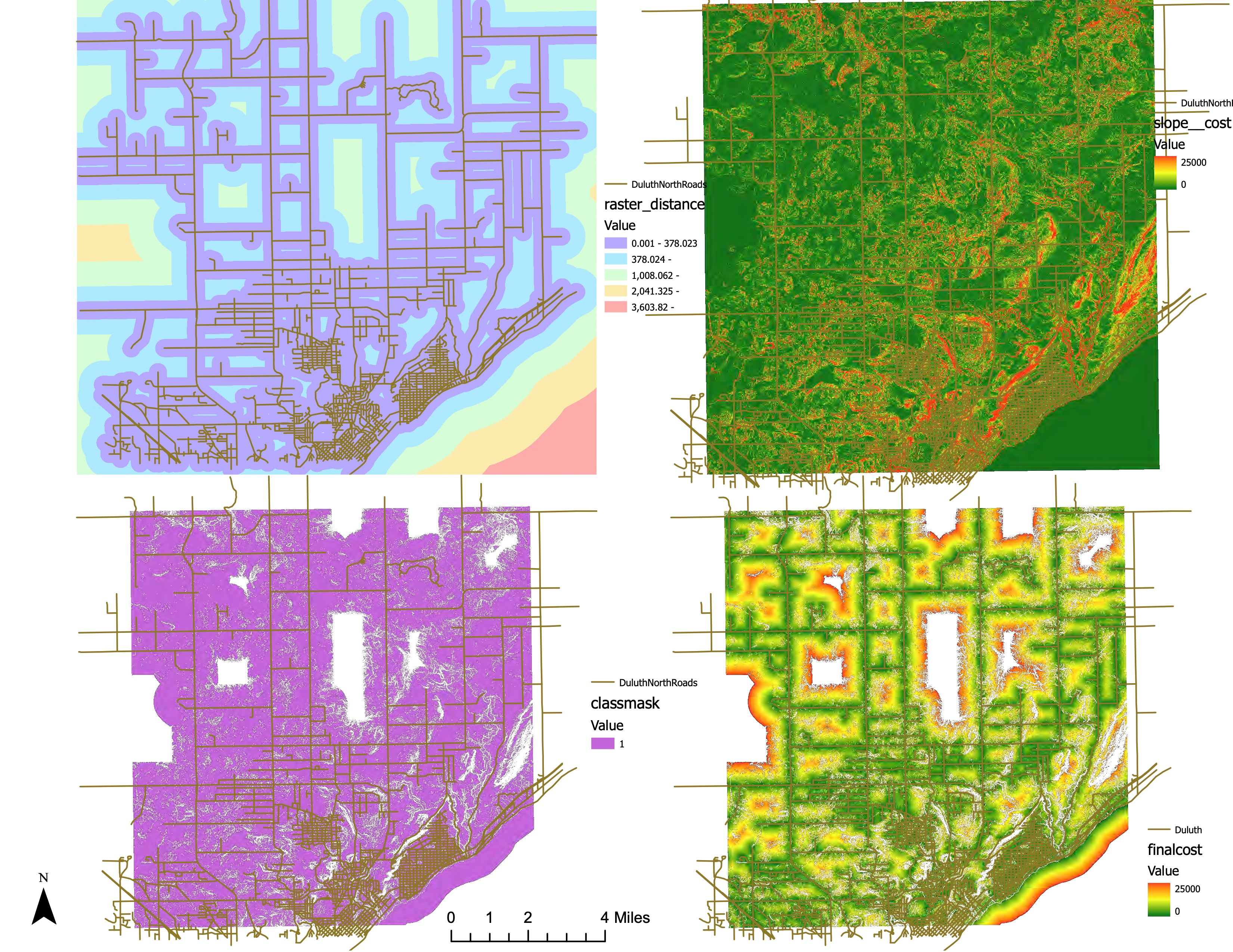
3.3 3. Develop a Cost Surface
- Calculate slope from DulNorthDEM and apply an exponential cost formula.
- Generate a distance raster using the Euclidean Distance tool.
- Combine slope and distance costs into a total cost surface, applying a threshold to focus on areas under $25,000.
3.4 4. Reclassification and Final Cost Calculation
- Reclassify the total cost surface to focus on areas below $25,000.
- Multiply the reclassified raster by the total cost surface to isolate areas within budget.
4 Results
4.1 Combined DEM Hillshade
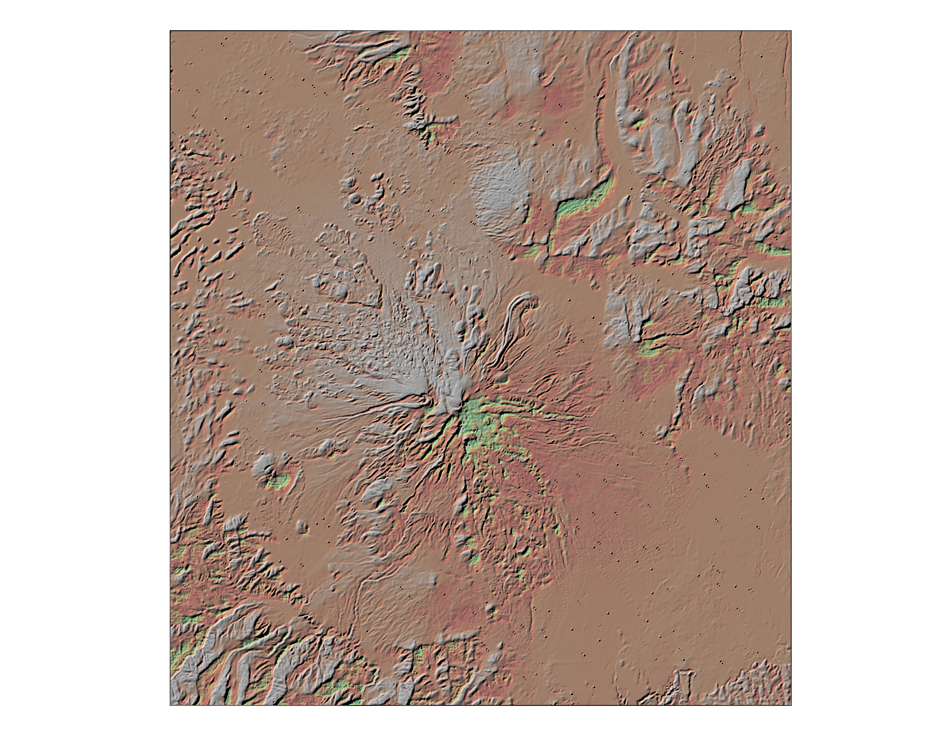
4.2 Filtered Shasta DEM Hillshade
5 Conclusion
This lab provided hands-on experience with advanced raster data processing techniques. The tasks included data resampling, DEM correction using filters, and cost surface generation. These techniques are crucial for spatial analysis in GIS, enabling more accurate modeling and decision-making based on geographic data.